The exploitation of the Floor Space Index (FSI) is a key factor in Mumbai’s increasingly unequal, profit-hungry urbanisation
Words by Vineet Diwadkar
Fears and desires have been projected onto Mumbai by politicians, investors and government planners through their 20th- and nascent 21st-century visions for what the city might become. These visions – or more accurately hallucinations – of Mumbai’s future float upon the single devastating measure of the Floor Space Index (FSI), introduced in 1991 as a planning tool and continuing in use today.
Following the Second World War, New York City architects developed Floor Area Ratio (FAR), the equivalent of FSI, as a new way to allocate built-up area to a locality’s carrying capacity. This added to the existing vocabulary of building regulations that emerged between the 1890s and 1910s to mitigate safety risks within the city’s tenement buildings.
FAR is defined as the ratio of a building’s total floor area to the size of the piece of land upon which it is built; the higher the number, the more development is allowed. It means the difference in density between Manhattan, where FAR is 8–18 and Paris, where it’s 1–5 and hence there is a great deal more open space between buildings.
Another early innovation, Transferable Development Rights (TDR), enabled the strategic movement of FAR throughout Manhattan’s chess board of land during the booming 1950s and 1960s, which meant that large volumes of built-up area could be concentrated in single parcels and blocks with the infrastructural carrying capacity to support it.
FSI has provided a basic quality of life for Mumbai’s residents by scaling the built-up area to match the locality’s carrying capacity, which is essentially the ability of local infrastructure, parks, and schools to serve residents to meet collective standards. FSI limits have provided flexibility for architects to design the same volume of space with varying building footprints and heights. FSI in Mumbai has evolved over time and in step with upgraded infrastructure and the addition of public spaces and amenities. More importantly though, it has increased as people have aspired to consume more floor space per person.
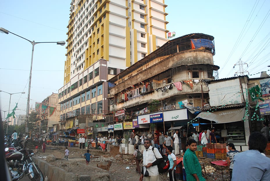
FSI has become the most significant planning tool in Mumbai’s urban development of the past 25 years. Yet, after this quarter century of manipulation in Mumbai’s real estate market, FSI is no longer linked to a locality’s carrying capacity. It is now assumed that FSI can be randomly increased without consequence for living conditions in a local area. Politicians, developers and planners argue that vastly increasing the index is the only way to cope with growing populations, even though encouraging those populations to remain in the city centre clearly leaves its infrastructure and amenities bursting at the seams.
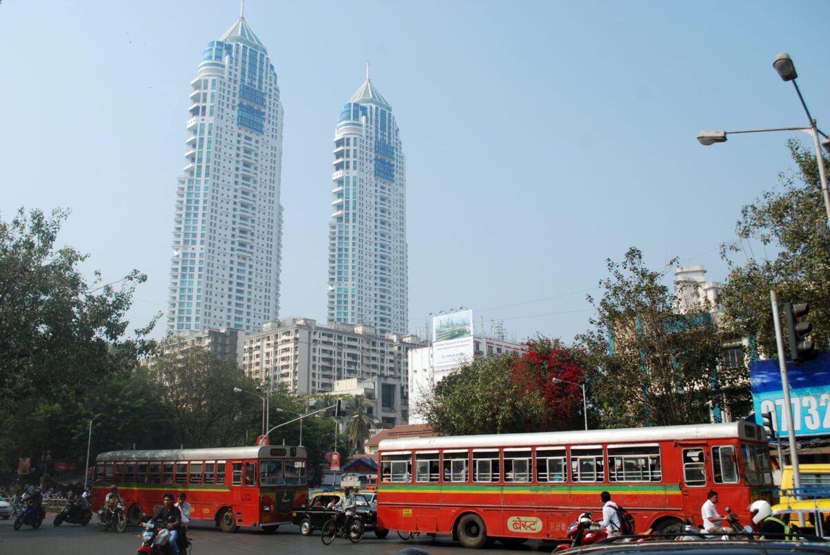
Since 1991, Mumbai’s urban planning authorities have systematically granted highly profitable FSI increases for builders and investors if they construct shoddy public housing. Nearly the entire building industry in Mumbai turns out luxury, high-rise condominiums that only the city’s wealthier classes can afford, forcing more than half of all Mumbai’s residents on to the streets.
Development Control Regulations (DCRs), introduced in Mumbai following India’s 1990 economic liberalisation, have famously targeted defunct mills, declared slums and tenements, and dilapidated structures for conversion. Recent amendments now incentivise large infrastructure projects, private car parks, and corporate IT Parks with profitable FSI bonuses.
In sea-locked Mumbai, builders and real estate financiers speculate on marginal categories since they have already extracted wealth from the early highs of the 1990s and early 2000s. Financiers pitch for investment to target the city’s 13,838 acres of mangrove swamps, 5,379 acres of saltpans, 1,780 acres of Mumbai Port Trust land, 756 acres of declared slums, and 247 acres of coastal land – with often devastating consequences for the environment. The destruction of mangrove forests and hardening of the coast have reduced the city’s ability to drain stormwater, increasing the prevalence and damage of flooding as witnessed in the devastating 2005, 2017, and 2019 monsoon seasons.
Three specific zones within Mumbai – Dharavi, M East ward and Dahisar – are frontiers where slums persist as a pattern for coastal urbanisation in the city’s history as a trading, industrial, and financialised engine for economic growth. Much coastal settlement lies within three metres of either the groundwater table or sea level, placing most of the city’s estimated 20 million population at high risk of disappearance in this century as sea levels rise.
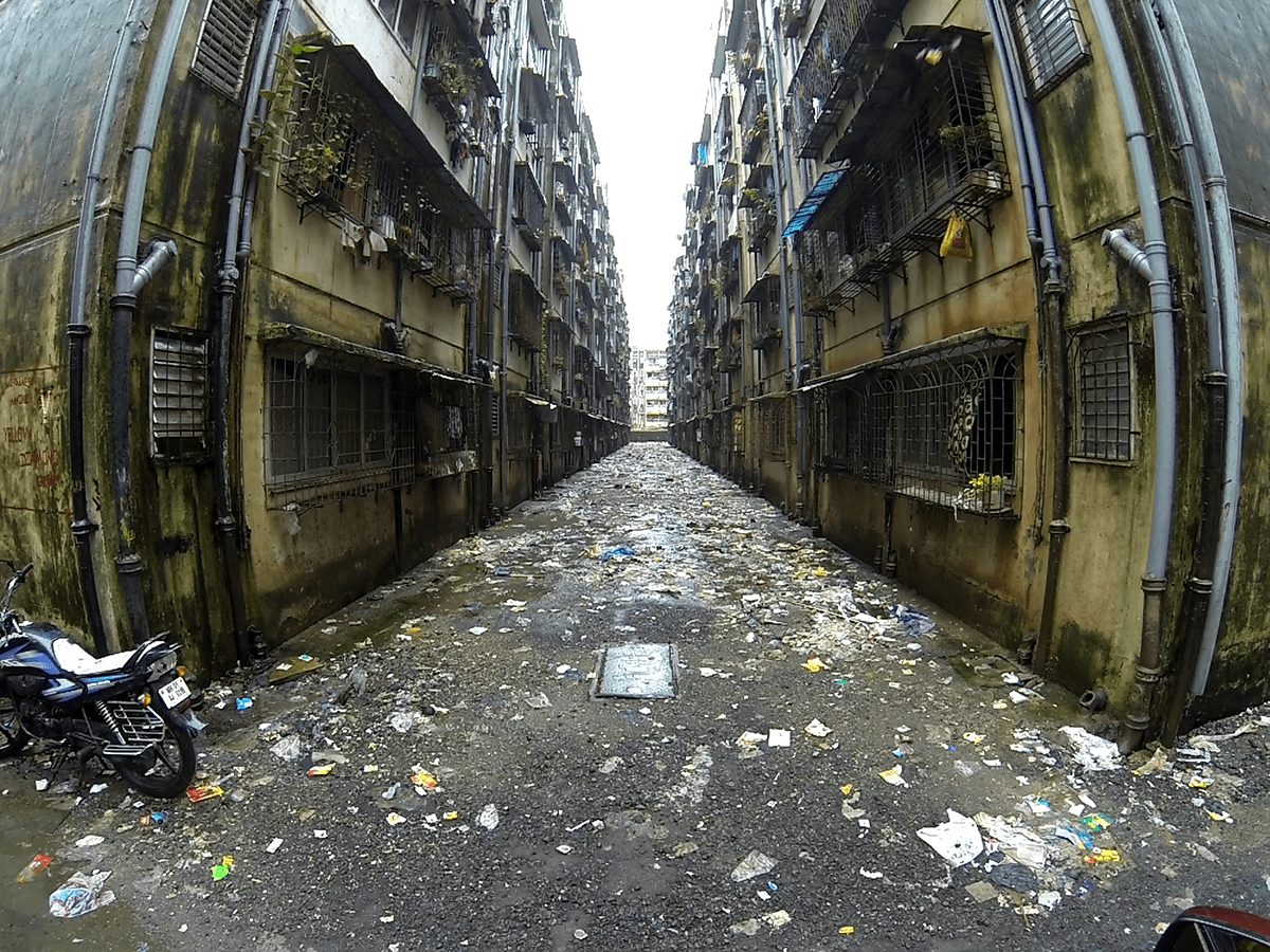
Several case studies from Mumbai reveal life inside and outside of the city’s FSI hallucinations. They seed alternate possibilities that are present in provisioning infrastructure, in collective organisation, and in managing risks.
As a result of World Bank-funded transportation and infrastructure projects from 2002 to 2013, an estimated 53,000 Mumbaikars were displaced during the following ten years, with eligible residents relocated to transit camps and resettlement colonies, and ineligible residents dispersed without assistance to other settlements throughout the city.
The relocation of eligible residents into landscapes composed of 21 sq m units packed in a minimal footprint has generated a total 1.1 million sq m of TDR (Transferable Development Rights) for sale, manipulation, and consumption of market-rate development potential in Mumbai, with over 70% generated from the city’s M ward alone. In this era of the ‘Builder Raj’, a small core of real estate developers and politicians hold a majority of the city’s development potential locked away in their vaults as TDR certificates.
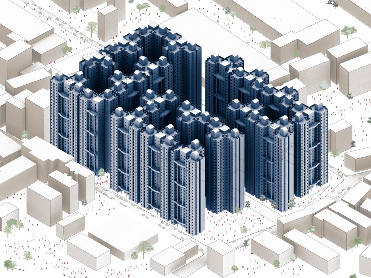
Lallubhai Compound is a 65-building relocation and rehabilitation colony built in 2005 in M East ward’s Mankhurd wetlands that has absorbed displaced residents from at least 38 communities across the island city and suburbs. Through the DCR-supported building of more than 10,000 relocation units on their site, Lallubhai Amarchand Ltd has generated at least 40,467 sq m of TDR with the sole requirement that its consumption is a site north of this particular Mankhurd land parcel. To accommodate all of the lucrative TDR generated by sites like Lallubhai Compound, politicians and planners have increased FSI from 1.33 to 5 in the island city and from 2 to 5 in the suburbs, more than doubling the built-up area above the same failing infrastructure.
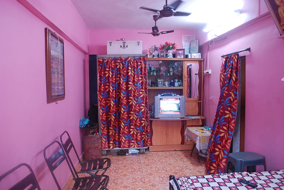
The 21 sq m unit is legally the spatial entitlement of the displaced when they are ‘rehabilitated’ to buildings on-site or relocated to buildings off-site. Residents adapt their new spaces in accordance with their ability to meet the maintenance expenses of ‘modernity’ – namely electricity, cleaning, and a portion of building maintenance fees, with 67 per cent of one study’s respondents struggling to adapt socio-economically to life in these new sites. Each of these sites warehouses the urban working poor into 21 sq m tenements loaded 22 to a floor, six stories high, in buildings spaced between two and six feet apart to maximise the generation of TDR from the land parcel.
Mumbai’s largest slum Dharavi (from Dharavé, meaning ‘from the sea’) has been cultivated from peripheral wetlands to support cotton milling, leather tanning, and the dumping of refuse during and immediately following British colonisation. Dharavi now supports 500,000 residents and is a global centre for materials recycling and garment and leather fabrication. Small-scale, marginal entrepreneurs and labourers sort and clean over 170 kinds of plastic manually from India and Europe. Plastics recyclers’ distribution associations consolidate representation from plastics sourcers, sorters, melters and wholesalers to coordinate logistics and spatial adjustments, and to network for shared business interests.
Nearby, Koli villagers have built fish farming tanks out of berms of mud and refuse, where over the past 60 years, they have manipulated tidal flows of salt and fresh water at the tail end of waste dumping and municipal sewage outfalls taking place in Dharavi.
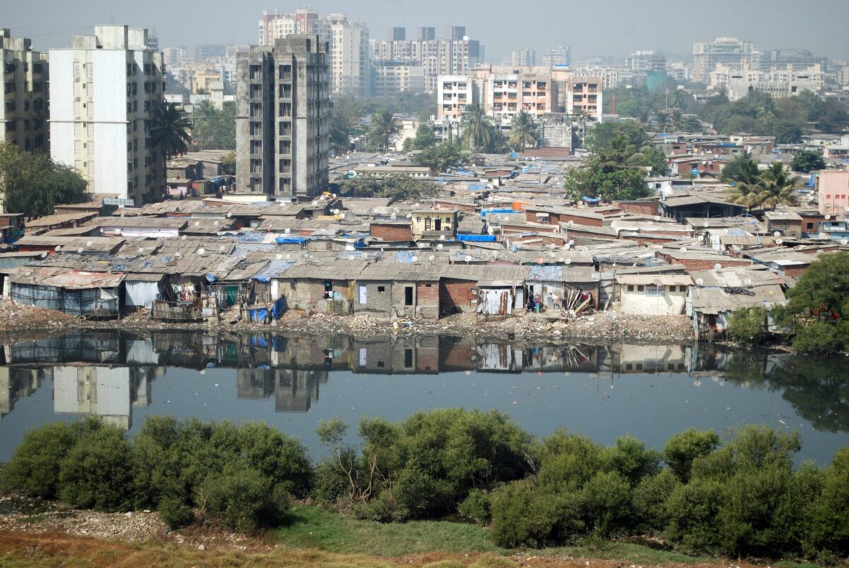
On the edge of Mumbai’s oldest dumping grounds and the Thane Creek mangroves in Deonar, Rafinagar is a settlement developed around salvaging, sorting, processing, and aggregating waste to sell to wholesale vendors. With no other vacant land to occupy, they clear mangroves, displacing the wetness of mud with foundation walls, and stake poles to extend settlement further into the swamp.
Further afield in the northern edges of the Mumbai Metropolitan Region, Dahisar and Gorai provide glimpses into how speculative urbanisation might continue to structure the region in coming years. Occupants in newer factory neighbourhoods and waste-salvaging settlements eye adjacent 50-storey residential towers that are sprouting amid fields of crops. Land is filled and sewage pipes aligned behind locked gates; signage makes appeals to non-resident Indians for safe investments in ‘emerging market’ real estate.
A boat crosses Manori Creek to Gorai, where the incoming tide saturates sand and mangrove roots. This western appendage of Salsette Island slides into the Arabian Sea, suggesting Mumbai’s earlier configuration as seven islands of mangroves, bays, and shallow tides. The Mumbai Metropolitan Regional Development Authority is financing new FSI hallucinations for a Gorai Special Entertainment Zone to join the existing EsselWorld Amusement Park and Vipassana Meditation Centre further south. Responses to reality remain on hold.
Vineet Diwadkar is an urban planner and infrastructure specialist. He is co-author with Vyjayanthi Rao of 50 Ways to Game a City: Loophole Planning in Mumbai, a forthcoming title from UR Books


